| Most viewed - wb6ypf's Gallery |

2890 viewsMexican Evening Primrose
|
|
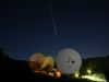
Full Moon At Triunfo Pass2883 viewsI've been spending some time at the AT&T Satellite Earth Station nestled in the Santa Monica Mountains near Malibu, CA.
Since it was clear, warm, and there was a Full Moon, I thought I'd try some more night shots of the Earth Station.
The Full Moon was illuminating the huge 32 Meter Dish on Antenna #3.
This is a 30 second exposure at f6.3 ISO400.
An airplane happened to be by passing by during the exposure.
It makes it look like a shooting star.
|
|
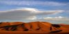
Sundown Dunes2877 viewsThe setting Sun was casting an orange hue on the Sand Dunes at Dumont. Dumont is located 30 miles North of Baker CA near the Southern tip of Death Valley. It was a windy day and the winds in the upper atmosphere were affecting the clouds. I m not sure I would classify this cloud as Lenticular but it was getting close. Taken 3/25/06.
|
|
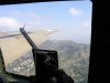
30 Seconds Over Hollywood2866 viewsView from the right Waist Gunners position as we flew over Hollywood. The Hollywood Sign can be seen in the distance.
|
|
ISS 9/2/20172858 viewsGood pass of the International Space Station. From West to North-Northeast. Magnitude -3.0. This was brought to my attention by a local viewer who happened to be checking the WeatherCam image early in the morning. Thanks Leo !
|
|
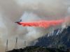
Air Show2852 viewsThats what they call the Aerial Assault on the fires. And Saturday was the "Air Show" in Altadena. Aircraft of all types and sizes were brought in. It was a photographers dream, but a homeowners nightmare.
Here, a McDonnell Douglas DC-10 makes a retardant drop over Brown Mountain. Can you imagine diving a Jumbo Jet through the canyons of the San Gabriel Mountains? It was incredible.
|
|
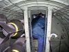
Tight Squeeze2847 viewsThis is looking forward from the Radio Room through the Bomb Bay. You had to walk through here to get to the front of the plane.
|
|

2841 viewsMy Father-In-Law Ron Hanke at the Radio Operators position.
|
|

On The Beach2840 viewsOn the beach at Poihale State Park. Several miles of warm sand along with some small sand dunes. We were one of only several groups along the entire stretch of beach.
|
|

2838 viewsLunchtime walks provided a refreshing break from the hard work being done at the Earth Station.
Prickly Phlox
|
|
2818 viewsSilver Bush Lupine
|
|
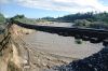
On The Wrong Track2817 viewsTaken 1/11/05
This photo taken along the Union Pacific Tracks by the Arroyo Las Posas in Somis, CA. After 5 days of heavy rain (14.38 inches at my station in Altadena) this river undermined the tracks and left them hanging high and dry. Unfortunately it took Fiber Optic Cables with it. AT&T, MCI, Sprint and Level 2 all experienced outages related to this slide.
|
|
| 348 files on 29 page(s) |
 |
|
|
|
|
|
|
12 | |
|
|
|
|
|